
Published
A closed cement plant is an attractive redevelopment site on paper. Large acreage, rail access, industrial zoning already in place, and frequently a water feature where the quarry has filled in. The difficulty is that on most of these properties the quarry was the disposal area as well as the source of the limestone, and the material placed in it has a chemistry of its own. Scoping the records half is close to former quarry and mine site reclamation, with a manufacturing legacy layered on top.
What a cement plant leaves
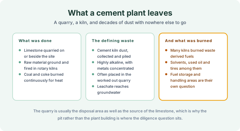
Limestone was quarried on or immediately beside the site, ground with other raw materials, and fired in rotary kilns at very high temperature. Coal and petroleum coke burned continuously to supply the heat, which means fuel storage, handling and ash areas across the property.
The defining waste stream is cement kiln dust. Collected from the emission control equipment and generated in enormous volume, it is strongly alkaline and concentrates metals that were present in the raw materials and the fuel. For most of the industry’s history it was piled on site or placed in the worked out quarry, and the leachate from those piles is what reaches groundwater.
The second issue is what else went into the kiln. From the 1970s onward many plants burned waste derived fuels, including spent solvents, used oil and shredded tires, under arrangements that were entirely lawful and generated their own storage and handling areas. Those areas are a separate question from the dust and are frequently in a different part of the site. A consultant scoping around the pile alone will miss them, and so will a records search scoped to the parcel containing the plant building.
What reaches the land record
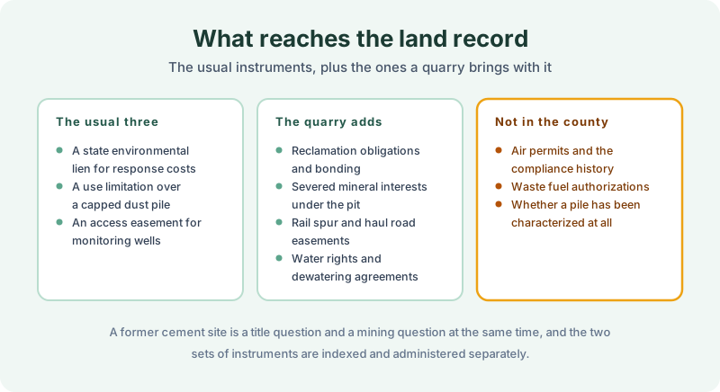
The usual three instruments appear here as anywhere. A state environmental lien where public money has been spent on response costs. An activity and use limitation, which on these sites typically covers a capped dust pile and bars disturbance of the cap. An access easement for monitoring wells.
The quarry brings its own set. Reclamation obligations and bonding under the state mining program. Severed mineral interests under the pit, which are common and which complicate any reuse. Rail spur and haul road easements crossing parcels that were later sold separately. Water rights and dewatering agreements, since a working quarry below the water table depends on pumping that stops when the plant closes.
What stays with the agencies is the operating history. Air permits and compliance records, waste derived fuel authorizations, and whether the dust pile has ever been characterized at all. A former cement site is a title question and a mining question at once, and the two sets of instruments are indexed and administered separately. Neither office holds a complete picture of the other, and nothing connects them automatically, so both have to be asked. Deed notices describing former operations appear on some closed sites and are worth looking for specifically.
Scoping the records work
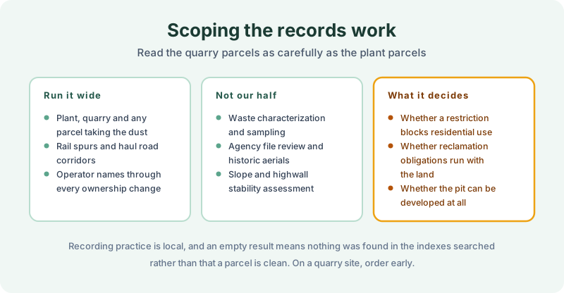
Run the plant, the quarry and any parcel that took dust, which is frequently not the parcel anybody is buying. Rail spurs and haul road corridors, because those were often conveyed away separately and carry easements in both directions. And operator names through every ownership change, since the industry consolidated repeatedly and the company named on a lien may be three names back.
Land title and judicial records from 1980 forward, on every parcel, with the instruments attached in full. Where a use limitation covers a capped area, the recorded exhibit describing that area is the document that decides whether a redevelopment plan survives.
Run it alongside the environmental professional. Waste characterization, sampling, agency file review, historic aerials and highwall stability assessment are theirs, and the REC call is the consultant’s. The buyer’s own user responsibilities stay with the buyer.
Order early. A restriction barring residential use over a capped pile ends a housing scheme on its own, and a reclamation obligation that runs with the land changes what the site costs before anything is built. Recording practice is local, and an empty result means nothing was found in the indexes searched over the period searched rather than that a parcel is clean.
The 1980 Environmental Lien & AUL report is where that records work gets done. Certified title abstractors review land title and judicial records from 1980 to the present and document every environmental lien, encumbrance, and AUL found, with the recorded instruments attached. It’s $425, delivered by email in 3–5 business days. Order online, or read how an environmental lien and AUL search is performed first.
Get an E1527-21 compliant lien & AUL report
Our 1980 Environmental Lien & AUL reports are researched by certified title abstractors, cover judicial records, and are guaranteed accurate. Delivered in 3–5 business days.
or call 877-848-5337