
Published
A graded field with a pond at one end, zoned for houses, priced attractively for the acreage. Thirty years ago it was a working sand and gravel pit, or a limestone quarry, or a small hard rock mine, and the ground under the new topsoil is whatever went back into the hole. The reclamation may have been done properly and permitted throughout. It may also have been a decade of uncontrolled filling nobody wrote down. The land record will not settle that on its own, and it will tell you a good deal about which one you are looking at, in the same way it does on a former landfill or disposal site.
Reading a pit in the chain
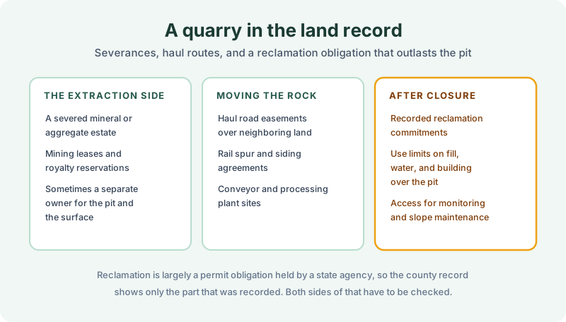
Extraction sites carry an unusual set of instruments. The mineral or aggregate estate is often severed from the surface, so a mining lease and a royalty reservation appear in the chain and a separate owner may hold the material while somebody else holds the ground. Haul road easements run across neighboring parcels, rail spur and siding agreements show where the product left, and processing plant sites sometimes sit on their own recorded parcel.
After closure, some of the obligation reaches the record. Recorded reclamation commitments, restrictions on fill and on building over the pit, and access easements for slope maintenance or monitoring all turn up on properly closed sites. Their absence is not evidence of anything, because reclamation is largely a permit obligation held by a state mining or environmental agency, and permits do not go to the recorder.
What went back into the hole
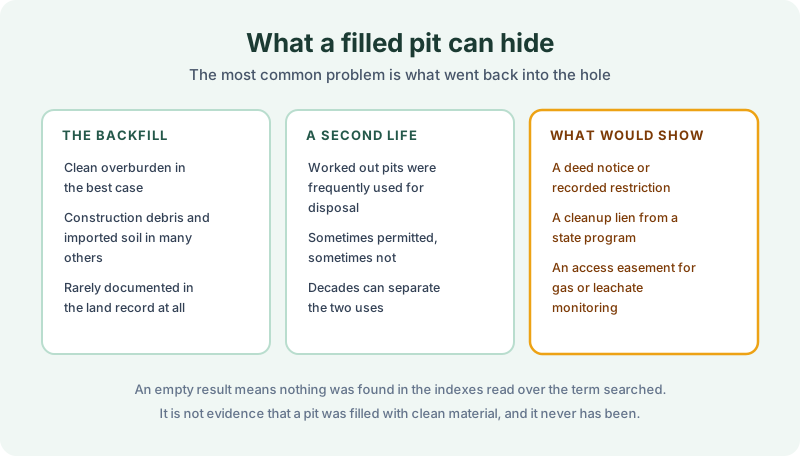
This is the question that matters most and the one the land records answer least. In the best case a pit was backfilled with clean overburden from the same operation. In a great many others it took construction debris, demolition waste, or imported soil of unknown origin, and none of that is documented in the county index at all.
Worked out pits were also, historically, extremely convenient places to put waste. Sometimes that second use was permitted, sometimes it was not, and decades can separate the extraction from the disposal so that the two look like unrelated histories. A formal waste use would leave traces worth searching for, including a recorded deed notice or restriction, a cleanup lien from a state program, and an access easement for gas or leachate monitoring.
Finding none of those means nothing was found in the indexes read over the term searched. It is not evidence that the pit was filled with clean material, and it has never been that. The distinction matters more here than on most sites, because the physical evidence is buried under a graded surface and there is nothing to see from the road.
Two records, and you need both
Mining and reclamation are regulated by state agencies, which hold the permit, the reclamation plan, the bond, and the release documentation. That file is where the question of whether reclamation was completed and approved actually gets answered, and it is the environmental professional’s territory rather than the abstractor’s.
The land record covers the other half. It shows the severance and who holds the material rights today, which matters because a severed aggregate estate can still be exercised. It shows the haul and access easements, which frequently outlive the operation and encumber ground the buyer assumed was clear. And it shows any lien, covenant, or use limitation that was recorded against the parcel. Recording and indexing practice varies by county, so a restriction filed in a plat book in one place may sit in the deed index in another.
What the report attaches
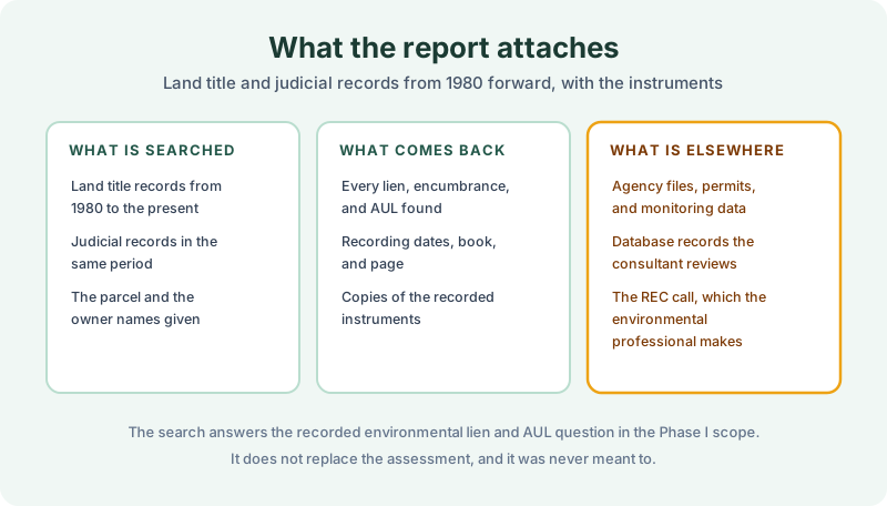
The report names the term searched and the indexes reviewed, lists every lien, encumbrance, and AUL found against the parcel and the names given, and attaches copies so the wording can be read rather than summarized. What sits outside it is the agency file, the database review, and the recognized environmental condition call, which belong to the consultant. Our note on data gaps covers how to record the limits honestly when coverage runs short.
A 1980 Environmental Lien & AUL report closes the recorded half of the question. Certified title abstractors review land title and judicial records from 1980 to the present and document every environmental lien, encumbrance, and AUL found, with the recorded instruments attached. It’s $425, delivered by email in 3–5 business days. Order online, or read our note on groundwater use restrictions in the land record for what a recorded limitation looks like in practice.
Get an E1527-21 compliant lien & AUL report
Our 1980 Environmental Lien & AUL reports are researched by certified title abstractors, cover judicial records, and are guaranteed accurate. Delivered in 3–5 business days.
or call 877-848-5337