
Published
Shipyards concentrate several industrial legacies on a single site, and they do it at the edge of the water where the boundary of the parcel is itself frequently uncertain. A former yard being redeveloped for housing or mixed use is one of the harder diligence assignments in the field, and the records portion of it has to be scoped deliberately rather than ordered as a standard product. The starting frame is the one set out in how an environmental lien and AUL search is performed.
What went on there
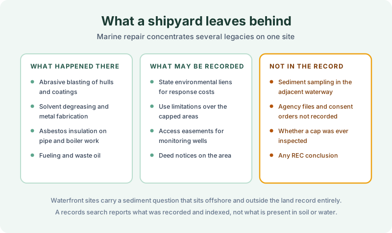
Hull maintenance meant abrasive blasting, stripping old antifouling coatings that in the relevant decades were heavily loaded with metals including copper, lead, and tributyltin. The spent grit went somewhere, frequently onto the ground or into the water.
Fabrication and repair meant solvent degreasing, welding, and machining, which is the same chlorinated solvent picture that drives former machine shop due diligence. Insulation work on pipe and boiler systems meant asbestos, in quantities that make these sites notable even among industrial properties. And fueling, bilge pumping, and waste oil handling ran throughout.
The result is a site where metals, solvents, petroleum, and asbestos are all plausible, usually in different places across the yard. That matters for scoping, because a single boring program designed around one contaminant tells you very little about the others, and the same is true of a records search built around one prior owner.
What can reach the land record
The same three instruments as anywhere. A state environmental lien where public money has been spent on response costs. An activity and use limitation restricting what may happen over a remediated or capped area. An access easement for monitoring wells. Deed notices describing the former operations appear on some closed sites.
What stays outside the record is most of the substance. Sediment sampling in the adjacent waterway, agency files, consent orders that were never recorded, and whether a cap has been inspected recently are all agency and operator material. A parcel can be clean in the county index and carry a closed disposal area at the back of it. That is the boundary of what recording captures rather than a failure of the search, and a report implying otherwise would be the more dangerous document.
The waterfront is a separate problem
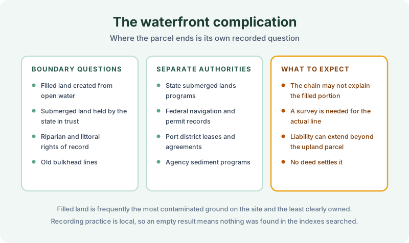
Much of a working yard is commonly filled land, created by placing material into what was open water, and on older sites that fill is frequently the most contaminated ground present. It is also the least clearly owned, because submerged land is typically held by the state in trust and the boundary between the upland parcel and the state’s interest moves with the history of filling.
Old bulkhead and pierhead lines, riparian rights, port district leases, and federal navigation permits all sit in this territory, and they are administered by several different authorities rather than by the recorder. The chain of title may simply not explain the filled portion, and settling where the line actually runs is survey work.
The sediment question is the one that most often changes a transaction. Liability for contaminated sediment can extend beyond the upland parcel, and nothing in the land record addresses it at all. Where a waterway has been designated for a federal cleanup, the allocation of cost among historic users becomes its own long-running process, and a buyer stepping into an upland parcel needs to understand where that process stands before committing.
Scoping the work
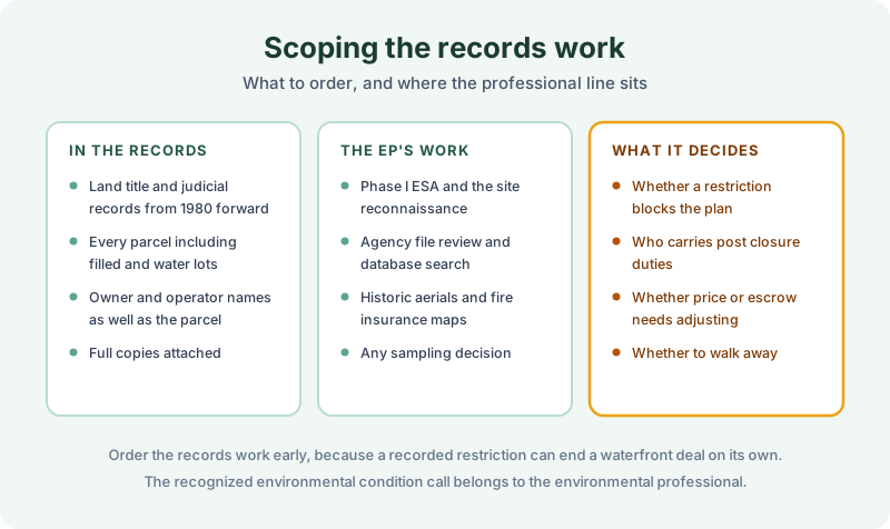
Land title and judicial records from 1980 forward, on every parcel in the transaction including filled and water lots where they are separately described. Run operator names as well as owner names, since yards were commonly leased and the operator may be the party a lien names. Instruments attached in full.
Run it alongside the environmental professional rather than instead of them. The Phase I, the agency file review, the historic aerials, and any sediment sampling decision are theirs, and the buyer’s own user responsibilities are obligations a consultant cannot discharge on their behalf.
Order early. A recorded restriction over a capped area can end a residential redevelopment on its own, and finding it in week one is worth a great deal more than finding it in week six. Recording practice is local, and an empty result means nothing was found in the indexes searched rather than that nothing exists.
The 1980 Environmental Lien & AUL report is where that records work gets done. Certified title abstractors review land title and judicial records from 1980 to the present and document every environmental lien, encumbrance, and AUL found, with the recorded instruments attached. It’s $425, delivered by email in 3–5 business days. Order online, or read what an environmental lien means once one turns up first.
Get an E1527-21 compliant lien & AUL report
Our 1980 Environmental Lien & AUL reports are researched by certified title abstractors, cover judicial records, and are guaranteed accurate. Delivered in 3–5 business days.
or call 877-848-5337