Published
Of all the restrictions that ride along with a contaminated site, the groundwater limit is the one buyers most often discover late. It rarely stops a sale, it almost never shows up in a listing, and on public water it changes nothing about daily life. Then someone plans an irrigation well, a geothermal loop, a pond, or construction dewatering, and the limit becomes the governing fact about the parcel. Like the restrictions described in our note on vapor intrusion, the underlying condition may be well documented while the paper that binds the land is somewhere else entirely.
Four ways a well gets closed off
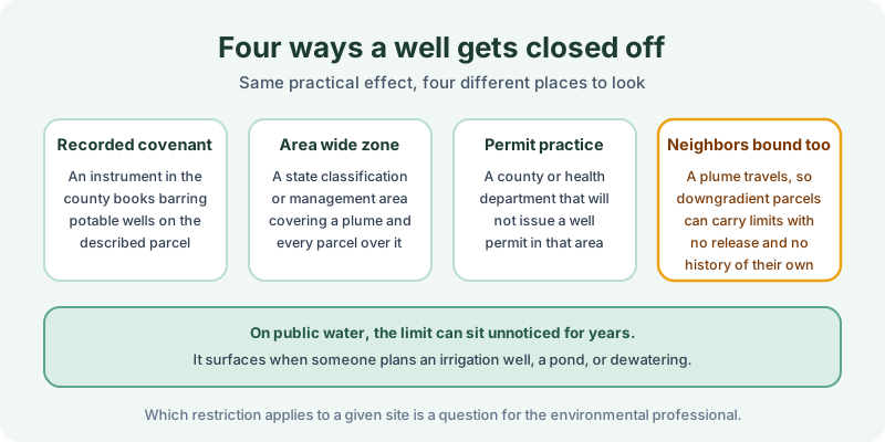
A recorded covenant is the cleanest case. An instrument in the county books, indexed to a described parcel, bars potable wells or any well at all, sometimes with a depth interval and a reporting obligation attached. An area wide zone is different in kind. Several states designate a classification area or management zone over a mapped plume, and the designation reaches every parcel above it whether or not any single owner was ever a party to anything.
Permit practice is the quiet third form. A county or state health department may simply decline to permit a new well inside a known plume, which produces the same practical result as a covenant without producing any document indexed to the land.
The fourth item deserves emphasis for buyers. Groundwater moves, so the parcels bound by a restriction routinely include neighbors who never handled a drop of the chemical involved. A property with no industrial history and a clean chain of title can still sit inside a zone that forecloses a well, and the owner may learn it from a permit clerk rather than from a closing.
Where the limit is written down
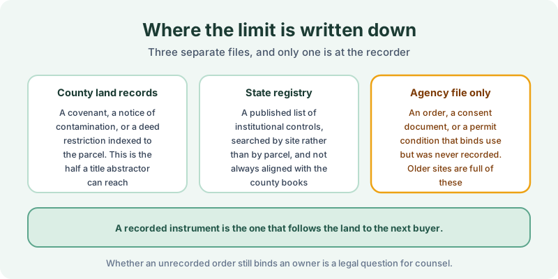
The three files rarely agree. County land records hold the recorded instruments, and that is the half a certified abstractor can reach and copy. A state registry lists institutional controls by site, which is a different key than a parcel identifier, and the registry and the recorder are often out of step; our note on institutional control registries treats them as two separate searches for exactly that reason. An agency file may hold an order or a permit condition that constrains use and was never recorded anywhere.
Timing explains much of the disorder. Groundwater restrictions became a standard closure tool during the 1990s and 2000s, well after many of the releases that produced them, so the sequence at an older site is often a release in the 1970s, an agency order in the 1980s, and a recorded covenant filed years later when the state closed the file or a redevelopment deal required it. The lien and AUL search window from 1980 forward is aimed at that recording era rather than at the release date.
That last category is the practical reason to look at both halves. A recorded instrument is the one that follows the land to the next buyer without anyone having to remember it, which is the whole point of the covenants described in our note on environmental covenants and UECA. Whether an unrecorded order still binds a successor is a legal question, and it belongs to counsel in that state.
Scoping the search
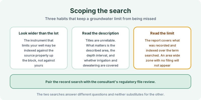
Three habits do most of the work. Look wider than the lot, because the instrument that limits your well is frequently indexed against the source property rather than yours. Read the described area rather than the caption, since a document titled as a notice may contain an operative prohibition and one titled as a declaration may contain nothing but a disclosure. Check what activities are actually covered, because irrigation, dewatering, and closed loop geothermal are treated inconsistently from state to state.
Sequence matters on a purchase. A groundwater limit can move a well site, add a water main extension, or make a planned basement or below grade parking structure a dewatering problem, and all three are cheaper to learn about during diligence than after a permit application. Ordering the record search early gives the site plan time to absorb the answer.
Then read the result honestly. A record search reports what was recorded and indexed over the term searched, and an area wide designation with no county filing behind it will not appear in any land records search, no matter how carefully it is run. That is a data gap rather than an all clear, and our note on data gaps covers how they get reported. The FAQ explains how we handle counties with thin indexing.
The 1980 Environmental Lien & AUL report is built for this half of the question. Certified title abstractors review land title and judicial records from 1980 to the present and document every environmental lien, encumbrance, and AUL found, with the recorded instruments attached. It is $425, delivered by email in 3–5 business days. Order online, or read our note on what an AUL actually requires before deciding what a restriction means for your plans.
Get an E1527-21 compliant lien & AUL report
Our 1980 Environmental Lien & AUL reports are researched by certified title abstractors, cover judicial records, and are guaranteed accurate. Delivered in 3–5 business days.
or call 877-848-5337