
Published
An activity and use limitation binds the land rather than the person who agreed to it, which is the entire point of recording one. That principle is easy to state and gets genuinely difficult the moment somebody redraws the lot lines. A restriction recorded in 1998 against a forty acre tract does not automatically explain itself to a buyer purchasing lot 14 of the subdivision that now covers it.
It survives almost everything
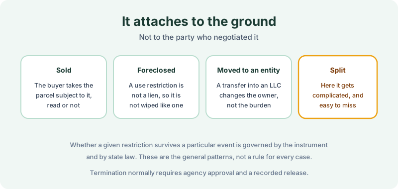
A sale does not clear it: the buyer takes subject to it, whether or not anyone read it. A transfer into an LLC changes the owner and not the burden. A foreclosure generally does not wipe it either, because a use restriction is not a lien and does not behave like one in a priority contest, though environmental liens recorded alongside it are a different question with different answers.
Ending one usually requires the agency’s approval and a recorded release or termination, on the theory that the restriction exists because contamination was left in place under controls. Whether a specific restriction survives a specific event turns on the instrument and on state law, and under UECA and its state analogues the mechanics are more standardized than they used to be. The general pattern holds: these are built to persist.
Splitting is where it gets hard
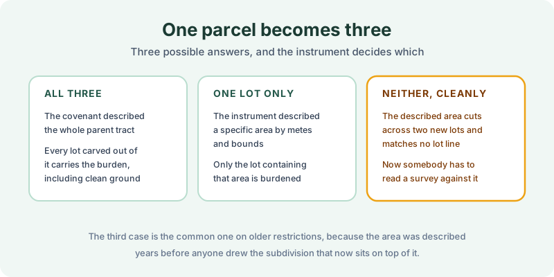
There are three outcomes, and the recorded instrument decides which one applies.
All the resulting lots. If the covenant described the entire parent tract, every lot carved out of it carries the burden, including lots on ground that was never affected by anything.
One lot only. If the instrument described a specific area by metes and bounds, the burden may sit on the lot containing that area and nowhere else.
Neither, cleanly. The described area cuts across two of the new lots and matches no lot line at all, so somebody has to read the description against a current survey to work out what is burdened. This is the common case on older restrictions, because the affected area was described years before anyone drew the subdivision now sitting on top of it.
Merging parcels runs the same problem in reverse. Combine a restricted parcel with a clean one and the resulting parcel has a restriction on part of it, described against a legal description that no longer matches the tax roll. Neither the recorder nor the assessor reconciles those for you. Recording offices index what is presented to them, and the assessor maintains parcel numbers for taxation, which is a different job with a different purpose.
Searching a lot that used to be a field
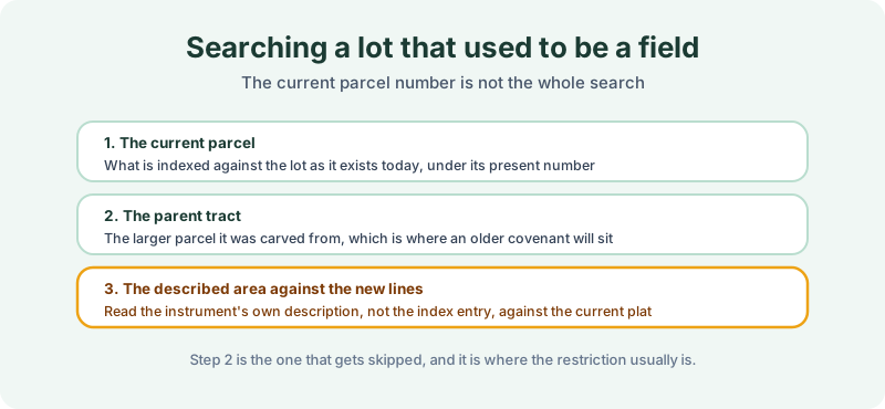
Three steps, and the middle one is the one that gets skipped.
Search the current parcel for what is indexed against the lot as it exists today. Search the parent tract it was carved from, because that is where a covenant recorded before the split will actually be. And read the instrument’s own description against the current plat, rather than relying on an index entry that says a restriction exists somewhere in the vicinity.
Step two is why we treat parcel history as part of the search rather than a preliminary to it. A chain of title shows the conveyances that created the current lot and identifies the tract it came out of, which tells an abstractor where else to look. Searching only the current parcel number on newly created lots is how restrictions get missed, and the same failure mode shows up on tax foreclosed parcels that were reconfigured before resale.
Where the registry helps, and where it does not
A state institutional control registry is worth querying here, with a caveat specific to this situation. Registries index by site or project, so a restriction listed under a facility name from 1998 may be findable that way even when the current lot number returns nothing. That is genuinely useful.
What the registry usually cannot tell you is which of today’s lots the restriction actually burdens, because it was not built to track subdivisions. The recorded instrument and the current plat answer that; the registry points you toward them.
Read the description, not the summary
None of this makes a restricted parcel unbuyable. It makes the described area a fact worth establishing before the price is agreed, particularly where a plan depends on ground that may sit inside it. Our 1980 Environmental Lien & AUL report covers the records half: certified title abstractors review land title and judicial records from 1980 to the present and document every environmental lien, encumbrance, and AUL found, with the recorded instruments attached. It’s $425, delivered by email in 3–5 business days. Order online, or read how the search is performed first.
Get an E1527-21 compliant lien & AUL report
Our 1980 Environmental Lien & AUL reports are researched by certified title abstractors, cover judicial records, and are guaranteed accurate. Delivered in 3–5 business days.
or call 877-848-5337