
Published
A residential developer options sixty acres on the edge of an old industrial town. The site held a brick works from 1911 to 1979, which sounds about as benign as heavy industry gets, and in terms of process chemistry it broadly is. The risk on these sites is not the kilns. It is the worked-out clay pit at the back of the property, which stopped being a pit the day it became somewhere convenient to put things. That makes this closer in character to a former landfill than to a chemical plant.
What a brick plant leaves
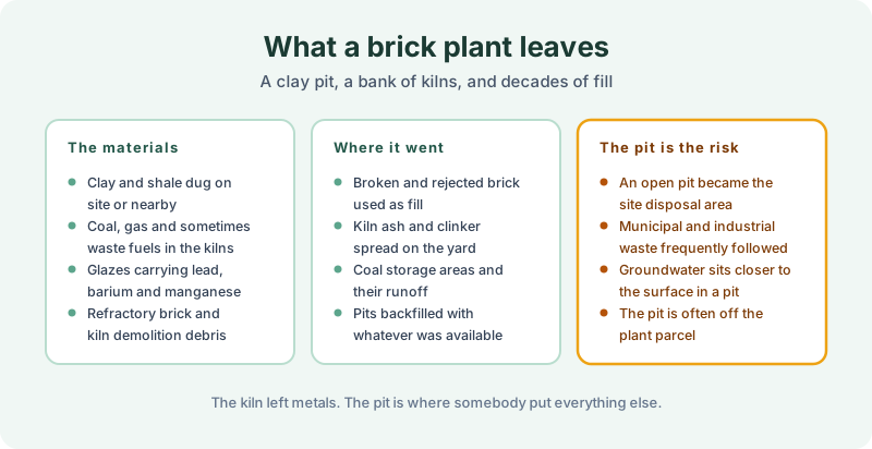
The materials are modest by industrial standards. Clay and shale dug on site or nearby. Coal, gas and on some sites waste fuels burned in the kilns. Glazes on faced and structural products carrying lead, barium and manganese. And refractory brick lining the kilns, replaced periodically, demolished eventually.
Where it went is the usual pattern. Broken and rejected brick used as fill across the yard, which is inert and useful and also means the ground is made rather than natural. Kiln ash and clinker spread wherever it was convenient. Coal storage areas with decades of runoff. And pits backfilled with whatever was available at the time.
The pit is the part that matters. An open excavation on an industrial property is an invitation, and a great many of them took municipal and industrial waste for years before anybody regulated the practice. Groundwater sits closer to the surface in a pit than in the ground around it, which shortens every pathway. And the pit is frequently not on the plant parcel at all, because clay was dug wherever the clay was.
Reading a brick site
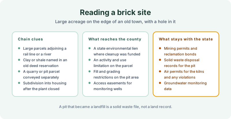
The chain signals are good ones. Large parcels adjoining a rail line or a river, because the product is heavy and the clay is heavier. Clay or shale named in an old deed reservation, which is a mineral severance by another name. A quarry or pit parcel conveyed separately from the plant, which is the single most useful clue available. And subdivision into housing after the plant closed, which is how these sites usually reach a modern buyer.
What reaches the county is the familiar set. A state environmental lien where public money funded work. An activity and use limitation on the parcel. Fill and grading restrictions over the pit area. Access easements for monitoring wells.
What stays with the state is substantial. Mining permits and reclamation bonds, solid waste disposal records for the pit, air permits and violations for the kilns, and groundwater monitoring data. A pit that became a landfill generates a solid waste file rather than a land record, which is the standing limitation in data gaps in an environmental lien search.
Why the separate pit parcel matters so much
Because it breaks the search. A buyer orders a search on the plant parcel, gets a clean result, and the recorded restriction sits on a different parcel that was sold to a neighbor in 1983 and has been quietly accumulating instruments ever since.
Clay extraction also follows the deposit rather than the property line, so the excavation frequently crosses onto adjoining land that was never part of the plant. That is the situation in adjoining property environmental lien searches, and on a brick site it is the normal case rather than an edge case.
Scoping the search
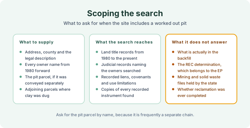
Give us the address, the county and the legal description, every owner name from 1980 forward, the pit parcel if it was conveyed separately, and the adjoining parcels where clay was dug. The pit parcel is the item worth chasing before ordering rather than afterwards.
What comes back is the land title and judicial record picture from 1980 to the present, with copies of every recorded instrument located. What it does not answer is what is actually in the backfill, the REC determination, which belongs to the environmental professional under ASTM E1527-21, or whether reclamation was ever completed.
The takeaway
Brick plants read as low risk and the clay pit is where the risk went. Find the pit, find out whether it was ever a separate parcel, and search it as its own chain rather than assuming the plant search covered it.
The 1980 Environmental Lien & AUL report documents the recorded side. Certified title abstractors review land title and judicial records from 1980 to the present and document every environmental lien, encumbrance, and AUL found, with the recorded instruments attached. It’s $425, delivered by email in 3–5 business days. Order online, or read the FAQ if you want the scope set out first.
Get an E1527-21 compliant lien & AUL report
Our 1980 Environmental Lien & AUL reports are researched by certified title abstractors, cover judicial records, and are guaranteed accurate. Delivered in 3–5 business days.
or call 877-848-5337