
Published
Retired oilfield ground is bought for cattle, for solar, and increasingly for housing on the edge of a growing town, and it is one of the few site types where the most serious feature is a hole in the ground somebody drilled sixty years ago. The record problem is distinctive because the party who caused the condition is almost never the party who owned the surface, and that split runs through everything. It is the same structural gap our note on leased property describes, in its most pronounced form.
What a production site leaves
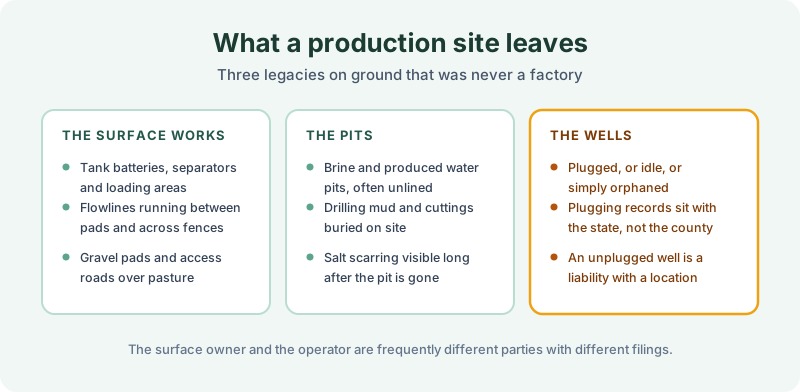
The surface works are the visible half. Tank batteries, separators, loading areas, gravel pads, and flowlines running between pads and across fence lines. Much of it is removed at the end of production and the pads and roads stay. Flowlines in particular are frequently abandoned in place rather than pulled, so a parcel can be crossed by pipe that nobody has thought about since the field stopped producing.
The pits are the part that does not photograph. Brine and produced water pits, frequently unlined on older sites, along with drilling mud and cuttings buried where they were generated. Salt scarring on the surface can persist for decades after the pit itself has been filled, and it is the most reliable field indication that one was there. Where a pit was closed by burying its contents, the closure is often undocumented anywhere.
The wells are the item that matters most. A well may have been plugged to standard, plugged badly, left idle, or orphaned when its operator dissolved. Plugging records sit with the state oil and gas regulator rather than with the recorder, so an unplugged well is a liability with a map reference and no county paper trail. Whether any of this is a recognized environmental condition is the environmental professional’s determination; the record question is narrower.
What may reach the land record
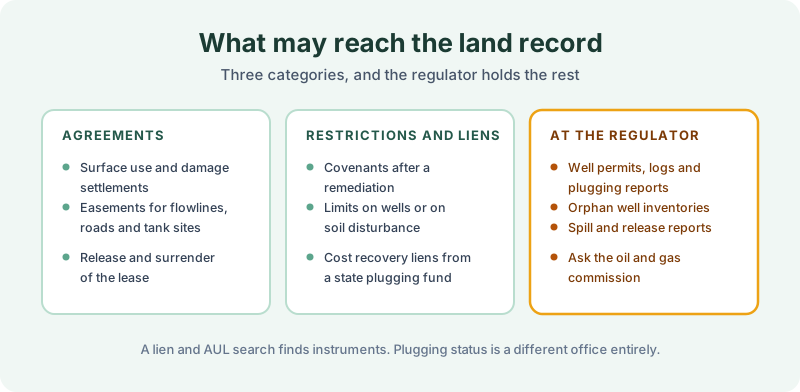
Agreements are the first category and the most likely to be there. Surface use agreements, damage settlements, easements for flowlines, roads and tank sites, and the release or surrender of the lease when production ended. Those are recorded against the tract and a search returns them with copies. A surrender of lease is worth finding for its date alone, since it fixes roughly when operations ended on that tract.
Restrictions and liens are the second. A covenant recorded after a remediation, a limit on sinking a well or disturbing soil in a mapped area, and cost recovery liens where a state plugging fund spent public money on an orphaned well. The covenant side is the subject of our note on environmental covenants and UECA, and the groundwater piece overlaps with groundwater use restrictions.
Everything technical sits with the regulator. Well permits, logs, plugging reports, orphan well inventories, and spill and release reports are held by the state commission, and several states track institutional controls in a database as well, which is why our note on institutional control registries treats that as its own search.
Scoping the search
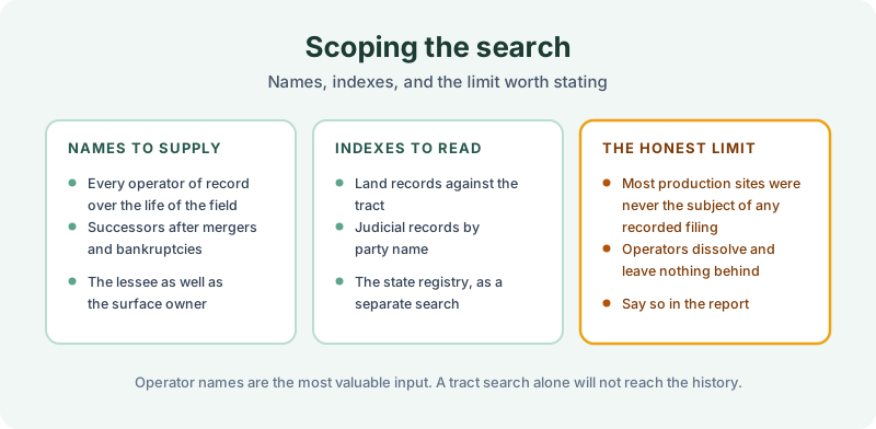
Operator names are the input that decides what the search can find. A field worked from the 1950s onward may have passed through six operators, several of which merged, were acquired, or went through bankruptcy, and an enforcement action or judgment against any of them sits in a court index organized by party name. That is the dependency our note on judicial records sets out, and on this site type it is the whole game.
Supply the lessee names as well as the surface owners, because the two chains are separate and the condition came from one of them. A buyer who knows only the family that has farmed the ground for three generations has supplied the half of the history least likely to produce a finding.
Timing is less helpful here than on most site types. A great deal of this activity predates 1980 and a great deal of what followed was never recorded against the land at all, so a clean report proves very little. The FAQ covers thin and unindexed counties, and a sample report shows the format findings arrive in. A search reports what was recorded and indexed over the term searched, and nothing found is not proof that nothing exists.
The 1980 Environmental Lien & AUL report is the record half of this work. Certified title abstractors review land title and judicial records from 1980 to the present and document every environmental lien, encumbrance, and AUL found, with the recorded instruments attached. It is $425, delivered by email in 3–5 business days. Order online, or start with our note on how the search is performed if you want the procedure first.
Get an E1527-21 compliant lien & AUL report
Our 1980 Environmental Lien & AUL reports are researched by certified title abstractors, cover judicial records, and are guaranteed accurate. Delivered in 3–5 business days.
or call 877-848-5337