Published
Rail property is the archetype that breaks the pattern. A gas station is a corner lot, a landfill is a defined footprint, but a rail corridor is a hundred feet wide and eleven miles long, crossing dozens of tax parcels and more than one county. Both the environmental question and the title question behave differently as a result, and the second one is where a records search earns its place.
Not all rail land carries the same history
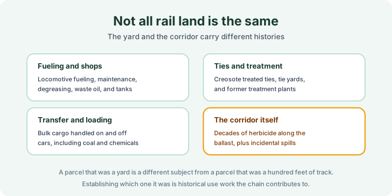
Risk on rail property concentrates where activity concentrated. Fueling and shop areas saw locomotive fueling, maintenance, degreasing, waste oil, and tanks. Tie yards and treatment sites involved creosote, which is why a former tie treatment plant is a substantially different subject from a stretch of track. Transfer and loading areas handled bulk cargo on and off cars, including coal and chemicals. And the corridor itself carries decades of herbicide applied along the ballast plus whatever was spilled incidentally over a century of operation.
A parcel that was a yard and a parcel that was two hundred feet of running track are not the same due diligence subject. Establishing which one it was is historical use work, and the chain of title contributes to it directly.
Why the chain is unusually hard
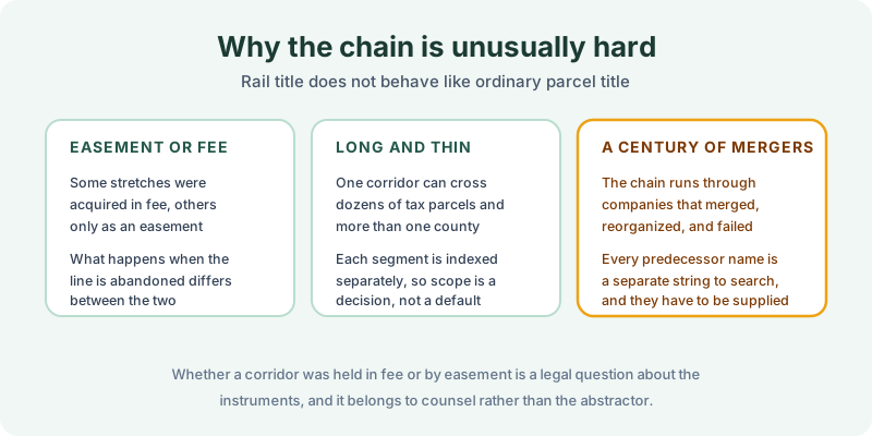
Three things make rail title its own discipline.
Easement or fee. Railroads acquired some stretches in fee and others only as an easement or right of way, and what happens on abandonment differs between the two. Which one applies to a given segment is a legal question about the acquiring instruments, and it belongs to counsel rather than an abstractor.
Long and thin. One corridor crosses many separately indexed parcels, sometimes several counties. Each segment is indexed on its own, so search scope is an explicit decision rather than a default, in much the same way a multi-parcel portfolio has to be scoped parcel by parcel.
A century of mergers. The chain runs through railroad companies that merged, reorganized, and failed repeatedly. Each predecessor name is a separate string in the index, and names that are not supplied are names that are not searched.
What abandonment leaves in the record
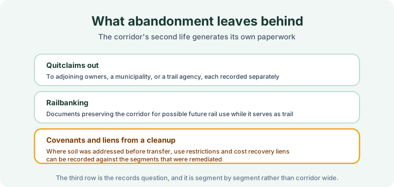
A corridor’s second life generates its own paperwork. Quitclaims out to adjoining owners, a municipality, or a trail agency, each recorded separately against the segment it conveyed. Railbanking documents preserving the corridor for possible future rail use while it operates as a trail.
And, where soil was addressed before a transfer, the instruments that matter here: use restrictions limiting excavation or requiring cover to stay in place, obligations that run with the land, and cost recovery liens. Those are recorded against the segments that were remediated rather than across the whole corridor, which is exactly why scope matters. A search of one segment says nothing about the next one.
Scoping a corridor search
Send the segment descriptions rather than a corridor name, and supply the predecessor railroad names the file has developed. Where a buyer is acquiring a specific stretch, the search runs against those parcels and the names in their chain. Where a municipality is taking a whole line, that is many searches rather than one, and pricing and turnaround follow accordingly. Budgeting for that up front avoids a scope conversation halfway through the project.
Adjoining owners have their own version of this question. A parcel that borders a former corridor can carry a recorded restriction from a cleanup that happened next door, the same reach-across problem that landfills create. Bordering the corridor is not the same as being inside it, and only a search of the specific parcel answers what is filed against it.
Where the records half stops
A search reports what was found of record for the parcels and term searched. It cannot tell you what is in the ballast, and the REC or CREC determination belongs to the environmental professional. What it can do is establish the ownership timeline, identify which predecessor operated the segment and when, and find every restriction or lien that a cleanup actually recorded.
Order the records half
Rail corridors are redeveloped constantly as trails, transit, and infill, and most segments carry nothing unusual. The ones that do carry it in writing. Our 1980 Environmental Lien & AUL report covers that half: certified title abstractors review land title and judicial records from 1980 to the present and document every environmental lien, encumbrance, and AUL found, with the recorded instruments attached. It’s $425, delivered by email in 3–5 business days. Order online, and if something surfaces, here is how to read it.
Get an E1527-21 compliant lien & AUL report
Our 1980 Environmental Lien & AUL reports are researched by certified title abstractors, cover judicial records, and are guaranteed accurate. Delivered in 3–5 business days.
or call 877-848-5337