
Published
The archetypes in this series so far have all been industrial: a gas station, a dry cleaner, a machine shop, a landfill. Former farmland is the one that does not look like any of them, and it covers an enormous share of suburban America. A subdivision built where an orchard stood is an extremely ordinary thing, and the diligence question it raises is unlike the others.
Legal, routine, and undocumented
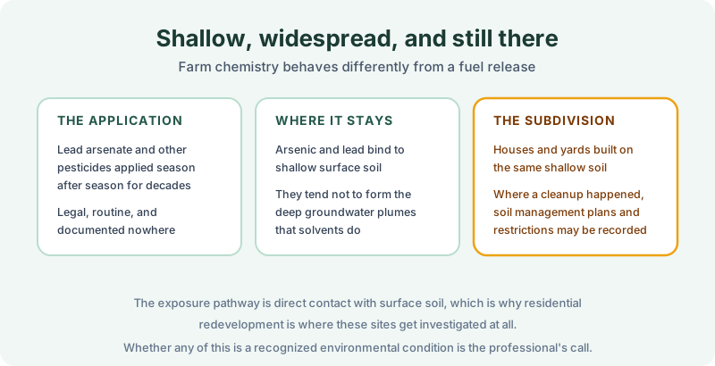
For much of the twentieth century, orchards were treated with lead arsenate and related compounds, season after season, entirely lawfully. Other pesticides followed. None of it was a spill, nobody reported anything, and no permit records the applications the way a UST installation gets recorded.
The chemistry then behaves unlike a solvent release. Arsenic and lead bind tightly to shallow surface soil rather than migrating down into an aquifer, so these sites generally do not produce the deep groundwater plumes that drive dry cleaner and machine shop investigations. The concern is direct contact with surface soil, which is precisely why residential redevelopment is the context where these parcels get examined at all. A warehouse over a former orchard rarely prompts anyone; a hundred houses with vegetable gardens sometimes does. Schools and childcare sites draw the same attention for the same reason.
Whether any of this amounts to a recognized environmental condition is a determination for the environmental professional, and it turns on state screening levels, sampling data, and the intended use. It is not a records question.
Reading farm history in the chain
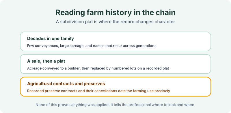
The records half contributes historical use evidence, and farmland leaves a distinctive pattern. Decades in one family with very few conveyances and large acreage. Then a sale to a builder, and a recorded subdivision plat replacing acreage with numbered lots. That plat is the moment the record changes character, and it dates the transition precisely.
Agricultural preserve contracts are the useful specific. Many states record preserve or open-space contracts against farmland in exchange for tax treatment, and those instruments and their cancellations date the farming use to the year. A chain of title search surfaces all of it, and none of it proves anything was ever applied. It tells the professional where to look and over what period, which is what historical use evidence is for.
Two very different records
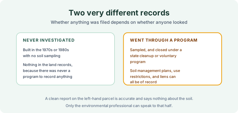
Former farmland splits into two populations, and the difference is whether anyone ever looked.
A parcel developed in the 1970s with no soil sampling carries nothing in the land records on this subject, because there was never a program to record anything. A search comes back clean and that result is accurate. It says nothing whatsoever about the soil.
A parcel that was sampled and closed under a state cleanup or voluntary program is a different matter. Those closures can produce recorded soil management plans, use restrictions limiting excavation or requiring cover to be maintained, obligations that bind future owners, and occasionally cost recovery liens. Where a restriction exists, it is findable, and reading the instrument rather than a summary is how you learn what the parcel is actually bound to.
One wrinkle specific to this lane: a former farm becomes a subdivision, which means a restriction recorded against the parent tract may or may not burden the individual lot being bought. That is the subdivision problem, and it is why the parent tract belongs in the search.
Where the records half stops
A search reports what was found of record for the parcel and term searched. On agricultural history that is a genuinely narrow contribution, and we would rather say so than imply otherwise. It cannot tell you what was applied, at what rate, or what remains in the soil. Sampling answers that, and the REC determination belongs to the environmental professional.
What it can do is establish the ownership and use timeline, surface recorded agricultural contracts, and find any restriction or lien that a closure actually produced. On a parcel that went through a program, that last part is the whole exposure.
Order the records half
Former farmland is developed constantly and most of it without incident. The difference on a parcel that was investigated is whether anyone read what the closure recorded. Our 1980 Environmental Lien & AUL report covers that: certified title abstractors review land title and judicial records from 1980 to the present and document every environmental lien, encumbrance, and AUL found, with the recorded instruments attached. It’s $425, delivered by email in 3–5 business days. Order online, or see a sample report first.
Get an E1527-21 compliant lien & AUL report
Our 1980 Environmental Lien & AUL reports are researched by certified title abstractors, cover judicial records, and are guaranteed accurate. Delivered in 3–5 business days.
or call 877-848-5337