
Published
A closed shooting range is one of the quietest problem properties in rural due diligence. There is no tank, no stack, and no obvious industrial building, so the parcel reads as vacant land right up until someone asks what the berms were for. The chemistry is simpler than a former metal plating shop, but the record problem is familiar: the operator was often a club with a lease, and the land itself may carry restrictions that never turn up in a casual county lookup.
What a range leaves behind
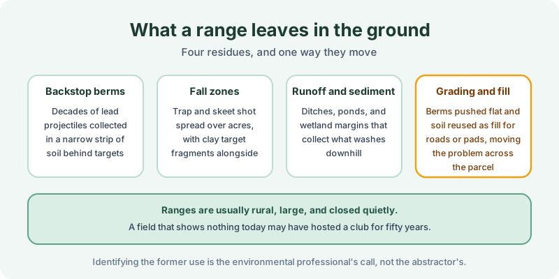
Backstop berms concentrate decades of lead projectiles into a narrow strip of soil behind each firing line, which is why a rifle or pistol range can present a very high concentration over a very small footprint. Fall zones work the other way. Trap and skeet shot spreads over acres of open ground, along with clay target fragments, so a former shotgun field is a broad, shallow condition rather than a hot spot.
Runoff and sediment matter because lead moves with soil. Ditches, farm ponds, and wetland margins downhill of the firing line collect what washes off the berm face, and those low areas are frequently the part of the site that draws regulatory attention.
Grading and fill is the item that turns a mapped problem into an unmapped one. When a club closes, berms get pushed flat and the soil often gets reused on site as fill for a road, a pad, or a low corner. Whether any of this rises to a recognized environmental condition is a determination for the environmental professional, not for the abstractor. The record contribution is different: what did anyone file about it.
What the record may carry
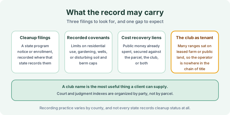
Three kinds of filings are worth hunting for. Cleanup program filings appear where a state records enrollment, a notice of contamination, or a closure document in the land records, and our note on voluntary cleanup programs covers how uneven that practice is. Recorded covenants are the most consequential item on a range, because the usual condition is not a prohibition on all use but a limit on residential development, gardening, well installation, or disturbing a soil cap over a consolidated berm. Those instruments are the subject of our note on environmental covenants and UECA. Cost recovery liens secure public money already spent and may run against the parcel, the operator, or both.
Timing is worth a note as well. Ranges have closed steadily for forty years, usually because a residential subdivision reached the property line and noise complaints followed, and that pattern puts many closures squarely inside the 1980 forward window a lien and AUL search covers.
The fourth item is the structural gap. A great many ranges operated under a lease from a farmer, a water district, or a municipality, so the club that generated the lead never appears as a grantor or grantee. An enforcement action or judgment against that club sits in a court index organized by party name, which is the dependency described in our note on judicial records. A club name supplied by the client is often the single most valuable input to the search, and the same relationship from the landowner’s side is covered in our note on leased property.
Scoping the search
Two practical wrinkles show up on these parcels. The first is acreage. Ranges are large, and a closed club is frequently subdivided into rural residential lots, so a covenant recorded against the original parcel may sit under a legal description that no longer matches any lot being sold. The second is registry coverage. Several states track institutional controls in a database rather than only in the county books, which is why our note on institutional control registries treats the registry and the recorder as two different searches.
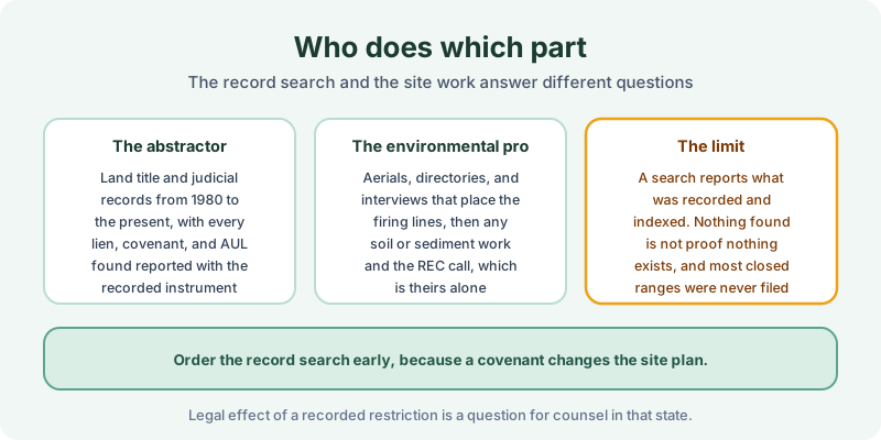
Read the result for what it is. A search reports what was recorded and indexed over the term searched, and most ranges that closed before modern guidance were never the subject of any filing at all, so nothing found is not proof that nothing exists. The FAQ covers how we handle thin or unindexed counties, and a sample report shows the format the findings arrive in.
The 1980 Environmental Lien & AUL report is the record half of this work. Certified title abstractors review land title and judicial records from 1980 to the present and document every environmental lien, encumbrance, and AUL found, with the recorded instruments attached. It is $425, delivered by email in 3–5 business days. Order online, or start with our note on what an AUL actually requires if a restriction has already turned up.
Get an E1527-21 compliant lien & AUL report
Our 1980 Environmental Lien & AUL reports are researched by certified title abstractors, cover judicial records, and are guaranteed accurate. Delivered in 3–5 business days.
or call 877-848-5337