Published
Small airfields close quietly. A general aviation field that served a county for fifty years becomes an industrial park, a distribution site, or a subdivision, and the runway survives for a while as an unusually straight access road. The parcels are large, flat, already graded, and well connected, which makes them attractive and makes the environmental history worth reading carefully. The record problem has the same shape as the one on a railroad corridor, where the party that generated the conditions frequently never owned the land.
What the field left behind
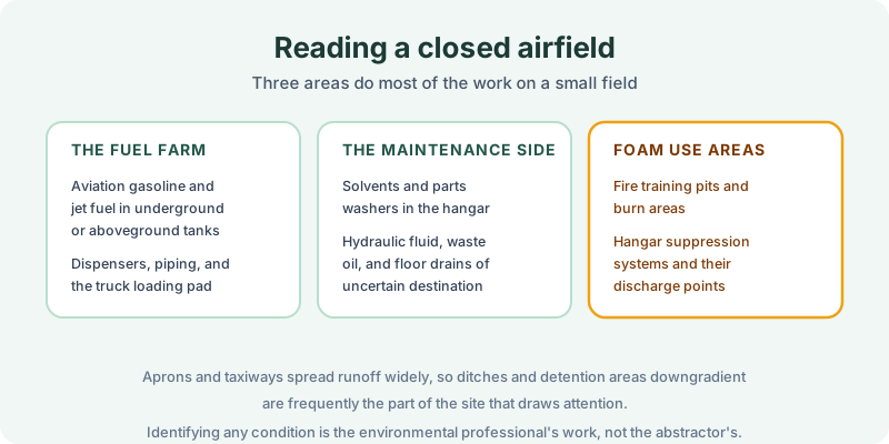
The fuel farm is the obvious one. Aviation gasoline and jet fuel were stored in underground or aboveground tanks, dispensed through piping of varying age, and transferred at a truck loading pad. Tanks at small fields were often installed decades before modern standards and removed, or abandoned in place, with paperwork that ranges from complete to nonexistent. The chain of title question this raises is the one covered in our note on a former gas station and its tanks, on a site with far more acreage around it.
The maintenance side ran on solvents. Parts washers, degreasers, hydraulic fluid, and waste oil moved through the hangars, and hangar floor drains of uncertain destination are a recurring feature of these sites.
Foam use areas are the item that has changed the analysis on airfields over the last decade. Firefighting foams were used in fire training pits and burn areas and were plumbed into hangar suppression systems, and the areas where they were discharged are now a routine subject of investigation. Whether any of this rises to a recognized environmental condition is a determination for the environmental professional, as our note on REC, CREC and HREC sets out. The record contribution is narrower, which is what anyone filed about it.
Aprons and taxiways matter for a different reason. They shed runoff across a wide area, so ditches, swales, and detention basins downgradient of the operating areas are frequently the part of the site that draws regulatory attention.
What the record may carry
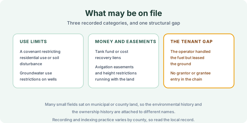
Three categories are worth hunting for. Recorded use limits are the most consequential, and on a former field they often take the form of a restriction on residential use or excavation, or a limit on installing a water well, the instrument type described in our note on groundwater use restrictions. Liens may arise from a state tank fund or from cost recovery for public money spent, and they can run against the parcel, the operator, or both. Avigation easements are worth noting even though they are not environmental, because they run with the land, they restrict height and structures, and they survive the airport that created them.
The fourth item is the structural gap. On a great many small fields the fuel and maintenance operations were run by a fixed base operator holding a lease, frequently from a municipality or a county, so the party that handled the fuel appears nowhere as a grantor or grantee. An enforcement action against that operator sits in a court index organized by party name, which is the dependency our note on judicial records describes, and the same relationship viewed from the landowner’s side is covered in our note on leased property. An operator name supplied by the client is often the most valuable input to the search.
Scoping the search
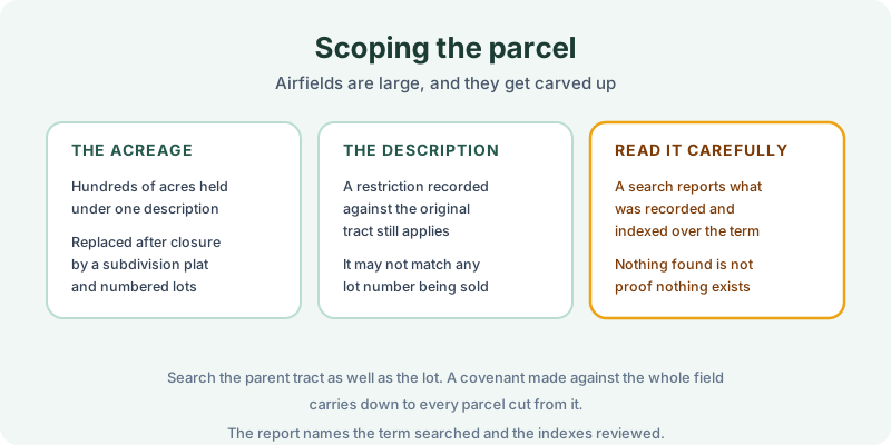
Acreage drives the scoping problem. A field held for decades under one large description is typically replatted into numbered lots after closure, so a restriction recorded against the original tract may not match the description on the lot being sold, the situation examined in our note on an AUL when a parcel is subdivided. Search the parent tract as well as the lot, because a covenant made against the whole field carries down to every parcel later cut from it.
Read the result for what it is. A search reports what was recorded and indexed over the term searched, and many small fields closed without any filing at all, so nothing found is not proof that nothing exists. The FAQ covers how we handle thin or unindexed counties, and a sample report shows the format the findings arrive in.
The 1980 Environmental Lien & AUL report is the record half of this work. Certified title abstractors review land title and judicial records from 1980 to the present and document every environmental lien, encumbrance, and AUL found, with the recorded instruments attached. It is $425, delivered by email in 3–5 business days. Order online, or start with our note on what an AUL actually requires if a restriction has already turned up.
Get an E1527-21 compliant lien & AUL report
Our 1980 Environmental Lien & AUL reports are researched by certified title abstractors, cover judicial records, and are guaranteed accurate. Delivered in 3–5 business days.
or call 877-848-5337